

RealEarth

RealEarth ၏ ရွင္းလင္းခ်က္
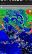
The RealEarth app provides access to real-time imagery and data products hosted by the University of Wisconsin - Madison Space Science and Engineering Center (SSEC). These products include global and regional remotely sensed atmospheric, terrestrial, and oceanographic imagery, observations of local meteorological parameters, and short-range predictions of future conditions. Features include:
- Select products to display by category, name, and time
- Pan and zoom map interface dynamically
- Display current location on map
- Animate by relative or absolute time steps
- Save custom favorites
Future enhancements will include capabilities for users to create custom geographic areas that will denote notification regions. Events such as severe weather, floods and fires will trigger a notification message directly to the user's mobile device.
Madison အာကာသသိပ္ပံနှင့်အင်ဂျင်နီယာစင်တာ (SSEC) - အဆိုပါ RealEarth app ကို Wisconsin ပြည်နယ်၏တက္ကသိုလ်ကတည်ခင်းဧည် Real-time ပုံရိပ်နှင့်အချက်အလက်ထုတ်ကုန်မှ access ကိုပေးသည်။ ထိုထုတ်ကုန်ဒေသခံမိုးလေဝသ parameters တွေကိုနှင့်အနာဂတ်အခြေအနေ Short-range ကိုခန့်မှန်း၏, ကမ္ဘာလုံးဆိုင်ရာနှင့်ဒေသတွင်းအဝေးကနေလေထုခံစားခဲ့ရ, ကုန်းနှင့်အဏ္ဏဝါဗေဒပညာရှင်များကပုံရိပ်လေ့လာတွေ့ရှိချက်များပါဝင်သည်။ အင်္ဂါရပ်များပါဝင်:
- အမျိုးအစား, အမည်, နှင့်အချိန်အားဖြင့်ဖော်ပြရန်ကို Select လုပ်ပါထုတ်ကုန်
- ပန်နှင့်သည် dynamically zoom ကိုမြေပုံ interface ကို
- မြေပုံ အပေါ်လက်ရှိတည်နေရာတငျပွ
- ဆွေမျိုးသို့မဟုတ်အကြွင်းမဲ့အာဏာအချိန်ခြေလှမ်းများ အားဖြင့်ရှိုကျ
- ထုံးစံအကြိုက်ဆုံး Save
အနာဂတ်တိုးမြှင့်အကြောင်းကြားစာဒေသများဖျောညှနျးလိမ့်မည်ဟုထုံးစံပထဝီဒေသများဖန်တီးရန်အသုံးပြုသူများအတွက်စွမ်းရည်များပါဝင်ပါလိမ့်မယ်။ ထိုကဲ့သို့သောပြင်းထန်တဲ့ရာသီဥတု, ရေကြီးမှုများနှင့်မီးလောင်မှုအဖြစ်ဖြစ်ရပ်များအသုံးပြုသူရဲ့မိုဘိုင်း device ကိုမှတိုက်ရိုက်အကြောင်းကြားစာသတင်းစကားကိုဖြစ်ပေါ်လိမ့်မည်။


